We did see a lot of wildlife out at night,though. We knew better than to swerve to miss the animals, but did try to brake to avoid them if possible. Unfortunately, the birds on the road were really slow to get out of the way, and we clipped a few of them. When we finally reached the T-intersection to turn south for Alice Springs in the middle of the night, we pulled over to add fuel from the jerry jugs and these birds were still stuck in our grill.

We finally rolled into Alice Springs in the morning. We were glad we'd brought the extra fuel in the jerry jugs as we wouldn't have made it this far without them! We showered in the public pay showers and hit the local grocery store. The next day was Australia Day and the town was bustling. We saw a crowd of Aborigines hanging out on the corner waiting for the liquor store to open. At the other end of the street, one angry Aborigine was punching and kicking and beating up on a youth that he apparently thought had done something worth getting smacked around for. This wasn't the best introduction to the locals here, but the "white fellas" in the Visitor Center say they try to leave them to their own ways of justice within their tribal customs, so they don't interfere when something happens like what we saw.
We hated the skinny, cutesy, curvy, curb-laden streets in Alice Springs. They were a chore to drive a large vehicle on. The visitor centers don't give away any good maps--you have to buy the useful ones--so we headed off to see King's Canyon using the tourist brochures we'd gathered. Jason wanted to do the "Rim Walk" at King's Canyon, where you must start at first light to get finished before you cook in the sunshine. They close the walk entry place at 8AM so folks can't get caught in the heat of the midday and need medical help for heat stress, dehydration and such. We really don't see these weather extremes in our country, and we aren't used to not having water and air conditioning available everywhere.
We took a shortcut/detour to see the Henbury Meteor Craters. The road was washboard rock and gravel I started hearing spurting hissing noises. We didn't realize it at the time, but that was the underinflated tire letting air out of what must've been a split; every time it rolled past a spot, it spurted out air. We kept driving along and then it became obvious we had a flat tire. It wasn't just flat, it was shredded! We were 5km from the meteor crater on a road normally only frequented by 4WD vehicles. And this was not the tourist season, so the traffic was practically non-existent.
 Some nice foreign guys stopped and helped Jason change the tire. Unfortunately, the spare was woefully underinflated, too, so we didn't want to blow that sidewall and get stuck out here. We rolled slowly to the meteor crater since we were already so close. They had this sign by the parking area warning us to close the gate to keep the camels out.
This is the actual crater, but it wasn't terribly exciting to look at. It's pretty impressive that someone found this spot and figured out what happened here, though.

We crawled at about 25mph through the night along the back road. Just our luck: a road grader had recently come through and scraped the road smooth the rest of the way and we couldn't take advantage of it; we had to keep the speed down to keep the tires cool as we really, really couldn't afford to get another flat tire out here. We'd flagged down the couple of 4WD vehicles we saw along the way to see if they had a tire pump, but none did, so we spent over 8 hours going the distance it should've taken us only a couple of hours to cover.
These are camel melons. They grow alongside the roads and are like a round gourd that dry from green to this tan color. They roads were made along old camel trails and the seeds are thought to have sprung from their dung.  If horses eat them, they get addicted to the sour taste and won't eat regular feed anymore and will starve to death. Or so we were told...
Wild camels along the road at night. It was pitch black so the flash didn't carry far enough for a great shot, so look closely. One side effect of going so slowly is that the wild animals didn't start and run from the van. If horses eat them, they get addicted to the sour taste and won't eat regular feed anymore and will starve to death. Or so we were told...
Karen on the King's Canyon Rim Walk.
A point on the track around the rim.
King's Canyon rock scenery.
View from the rim of King's Canyon. It's like a mini Grand Canyon.

Rocks fall and create cool formations.

A sheer face on one side of the canyon. Note there are no fences or ropes or guard rails to keep you from walking off the edge. Lawyers haven't gotten to that point here yet. You are still responsible for your own safety for the most part.

The other canyon wall, another sheer face.
You can't see these sheer faces even if you zoom in on Google Earth as they are in shadows.
Jason on the rim walk.

Another view of the sheer wall. You can see the white spot where a slab of rock has given way and fallen into the canyon below. The orange color is from a fungus that grows on the white sandstone; the rock isn't really reddish orange like it looks.
The lumps of eroded rock represent people in the local legends here. You can see these bumps in Google Earth.

Rock formation on rim of King's Canyon, Watarrka National Park, Northern Territory, Australia.
Don't worry, I didn't really deface the canyon. This is written with a piece of the white sandstone that had already been broken off. It's on a flat surface, so the next rain or wind and dust will take it away. All the canyon walls would have originally been white like the writing when the canyon was first formed, as all of Australia was once under water. These rocks and walls are mostly compressed sandstone that has been uplifted and eroded.

We finished the rim walk in under 3 hours on a cool cloudy morning, so we didn't feel the extreme heat that endangers some hikers. We found a 'resort' nearby with an air pump and finally got back up to speed in the campervan.
Not far down the road, we pulled off to investigate this salt pan lake. 
Jason walking to the salt pan lake. We didn't want to try to take the van any closer on the washed out, rutted track.

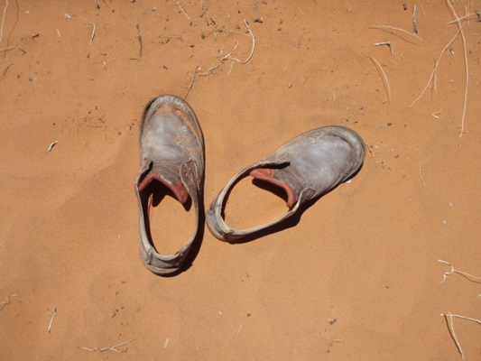
These shoes were left in an unusual place--The Mt. Connor Lookout. Its a red sand hill that provides a view of Mt. Connor, a butte that sticks up all by itself in the middle of nowhere in the Red Center of Australia. Mt. Conner, Uluru and Kata-Tjuta are the only 3 rocky outcrops for miles across the Red Center of Australia, and they all figure in Aboriginal lore. You cannot visit Mt. Connor as it is privately owned, so they made a roadside pullover to view it from a distance. Looking the other way, you could view the salt pan lake we'd stopped at earlier.
There was no person with these shoes that had been left on the sand, and I thought it was an interesting shot. The sand sneaking in through the holes in my Crocs was burning hot, so I hope this person wasn't up here in the daytime. The shoes were still there when we left.
We were running the fuel gauntlet and we kept a very close eye on the fuel gauge creeping towards Empty, hoping we'd make it to Erldunda, where the road met the main highway again. And that the town had an operating fuel station. We literally rolled up to the pump as the van ran out of diesel fuel and our jerry jugs were empty!
Erldunda only has 50 people, but they have these giant representations of a frill neck lizard and a spiny echidna. We had no idea why they were out here or what they were for; they were under a roof just sitting there with no signs or anything. They looked like they might have been part of floats in a parade or something. Months later I found out that they were part of the 2000 Sydney Olympics opening parade--cool! Amazing what you can find out in Wikipedia.


The next town was the last one in the Northern Territory--Kulgera. It, too, was sparsely populated, with the roadhouse being the only real draw here. The giant beer can was next to a beer-gutted man cutout where you could have your picture taken.
 Outside the bar was a sign I though was cute:
 And they had the inevitable shoe tree. You wouldn't dare walk barefoot on these hot surfaces, so I don't know how they got so many.
We ended up at Uluru, finally. Uluru used to be called Ayer's Rock, but was given back to the Aborigines in 1987 and then immediately leased back to the Aussie government to run as a National Park, co-managed with the Aboriginal tribal members. We took a guided tour with a ranger, who is half Aborigine, but I'd never be able to tell by looking at him. Discrimination by both Aborigines and white people as he grew up provided him with some interesting but sad stories to tell.
These are some of the rock paintings on parts of Uluru. 

Our guide, Rick, explaining some of the features of the rock and its uses in Aboriginal life and lore.

Rick explaining part of the painting. We'll never know ALL the story as that is reserved for pureblood Aborigines trusted with maintaining their culture, stories and laws.

A curved portion of rock that looks like a frozen wave.

Karen in the kitchen area of Uluru.

Different areas of the rock were used for different purposes and some of the places were segregated. Men dealt with men business and women handled women business. They didn't mix business; not to be sexist, but to protect their knowledge and make sure the right people were chosen to carry on the stories of their history. One must prove they are responsible enough to handle the information and make sure it gets passed down completely and correctly. There was no written history for these folks; they have maintained an oral history for tens of thousands of years out here!

This nook in Uluru reminded me of lips.

Aboriginal rock painting on the ceiling of a cave in Uluru.
More rock paintings at Uluru. The elders used these rock walls like a blackboard to teach younger members about life, legends, lore, survival, and all sorts of things.

More rock paintings on the walls of Uluru. These appear at different places around the base of the rock, in areas used for different purposes by the Aborigines who have been coming here for thousands of years. The ochre and colors used for painting are precious and were carried with them to this place to use.We'll never know the full meaning of these, and some Aborigines don't like people taking pictures of parts of the rock. In fact, it is forbidden to take pictures in some places around Uluru and the rangers strictly enforce it. The Aborigines feel we can't possibly convey the total "big picture" of Uluru and think we might give wrong information or people might get the wrong "story" if they only see a part of it as represented in a photo. It's too big a rock and too big a story to fit into a photo. 

People used to climb this monolith when it was Ayer's Rock. The Aborigines don't feel it's appropriate to climb a sacred place and strongly discourage the climbing of the rock now. The National Park is working towards closing the climb altogether, but in the meantime, they close it for safety reason when it is forecast to be 36 degrees Celsius or more. It gets too hot on this rock and people need to be rescued from heat stress and dehydration. It's becoming a point of pride to NOT climb the rock out of respect for the Aboriginal people. We didn't climb it, but you can see the rope guide in the photo below. It was used to walk to the top of the rock, the biggest exposed monolith in the world (and the exposed part is just a fraction of the entire rock!!). Our guide told us stories about having to push people back down the rope guide when they froze up out of fear trying to go down. It's not an easy trail.

A different view of part of Uluru.

 More Uluru from a different view.
 I didn't expect to see so many cubbyholes and caves in Uluru.
 This is probably the most famous view of Uluru. I'm at least 20km from it, but it barely fits in the frame. It is so much more interesting and involving when you get up close. It really is a special place.
An ironwood bench near the Visitor Center at Uluru. When funds were flush, they could afford to commission works like these, but they'd never be able to afford to get them again.

About 45 km away from Uluru is another rock formation, now known as KataTjuta. They used to be known as The Olgas. They, too, are red sandstone formations that have been worn smooth by time and erosion.

 The rounded forms of Kata Tjuta are striking in their own way. This is one of the overlooks into them.
 A sign warns about the extreme temperatures.
 Kata Tjuta from a distance.
 As seen driving from Uluru.


No comments:
Post a Comment