Reunion is often described with the adjective "spectacular". Indeed. This is one of my favorite photos of Reunion; I like the waterfalls. Someone told us this one was used in a Tom Cruise movie 'Cocktail' long ago, but I don't remember it. The water comes spouting right out of the rock. There is no river or flow of water above these falls. The rain just seeps through the limestone and comes out clean and pure. Some brave souls dared to swim across the cold water to get to the falls.
Jason and Karen at Grand Galet, the waterfalls. You could drive right up to here!
This was our entry into Reunion at Le Port. Some pretty sharp peaks there.
We got into the new marina on the first day it was open for visiting yachts. That is YOLO backed into our berth. If we'd gone in bow first, I couldn't get off the boat as the finger piers are too short and the jump up and down would be too great for me. A new marina that is already rife with issues and problems.
Even Jason couldn't move this anchor.
A big piece of machinery at the port. We think it is used to offload ships full of sugar, but we never saw it used.
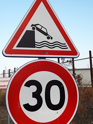
A sign at the old marina, around the corner from the new marina. Reunion has had a lot of folks eaten by sharks over the years and this is not a place where we'd get into the water. They've outlawed surfing at a primo spot because of the shark attacks.
If you look closely, you can tell this burned out chunk was once a boat. Only the bow remains. The number 7 may be lucky, but it is followed by a black cat, unlucky. I guess the cat won. This burned out hulk was stored just behind the old marina office.
Another sign at the old marina. A steep road led into the place, so I guess there must've been some incidents of someone in the past not making the turn at the bottom of the entry. Oops.
As we drove up the winding switchbacks, this purple flowering plant appeared everywhere. It was so pretty against the green foliage.
At the start of a lookout trail, these were the toilet facilities. Jason coming out of the round one.
The square one was the one I used. It's rare to find a decent public toilet anywhere these days, so we were happy to take advantage of these outhouses.
A view of the Cirque du Mafate, an old caldera with steep, rugged sides. The clouds roll up the mountainside about 10 AM each day, so you need to get here early to see the vista and look into the valley below.
The valley just before the clouds obscured the view for us.
A minute later and you can see me, but no valley behind me. Amazing how regular these clouds are.
They might roll away just as quickly for another glimpse, like this one, looking down into the valley in a different direction. How those folks in those buildings down there ever get anything is a mystery. It's a very inaccessible place.
A close up of the area where the homes are below. Pretty rugged.
The yellow flowers draw lots of bees, and the beard-like growth on the shrubs reminds me of the moss hanging from the trees in the bayous of Louisiana.
A cool shaped church we stopped at on our drive. That's Jason next to our driving billboard of a car,
Looking back from one of the switchbacks as we headed up into the hills to see the volcano cirque. That may be Le Port way off in the distance along the shore.
Jason eating a baguette with peanut butter and jelly. Sustenance on the road.
We stopped at a sugar cane loading facility that happened to be where we turned off to go to a waterfall. Hard to believe they can harvest sugar cane on these steep slopes, but they do.
The clear blue river along the road as we drove to the waterfall of Grand Galet,
A pool along the river. I can't believe how clear the water is in a river so far downstream from the source.
The folks swimming in the pool below the waterfalls. They left the dog sitting on the rocky shore.
Jason looking at the water as it spouts out of the rock into the falls.
another river pool view.
The cloud lays right over the top of the mountain and down the other side. We are heading up to see the volcano in the early morning with Charles from
Saol Eile with us.
You can see the frost on the grasses and shrubs as we drove up the winding road. It was cold!
A valley vista on the way up. Still in shadow in the morning, but you can also see some of the haze from the volcano not far away.
As we crested the hill, you could see these old lava plains below. Still frost on the bushes.
More frosty lava from eruptions gone by.
I like the red of the lava hills in the distance. We buy bags of this stuff as red scoria to line flowerbeds and walkways.
We set off in the morning, bundled against the cold, to so see the rim of the erupting volcano, La Fournaise (the furnace).
A shrine along the way made from chunks of lava rock piled up. I was praying for warmth!
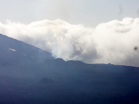
We're still miles away, but this is as close as we got. You could actually see the rocks being thrown up into the air and the column of gas, but once the sun comes up, you can no longer see the orange rivers of lava flowing. Most folks go up here at 4:30 AM with flashlights and dressed to ward off the freezing cold, but we weren't that game to do it. We still saw the eruptions and Charles had never seen a volcano before, so it was all good.
Jason and Charles heading back to the car. We bundled up with everything warm we had and were still cold. But once the sun came up, it started to get warmer and by the time we got back to the car, we were shedding the cold weather gear.
Jason on the path next to the ribbon lava.
A nice view on the road up to the volcano. The vegetation changed with the altitude.
That same valley view as earlier, with a bit of sun shining in it now. That skinny line through the green trees is a river in the valley. We're several miles above it, looking down.
Our lunch stop in the pine trees in a park. White lilies grew wild all around here.
On the other side of the Cirque du Salazie, another old caldera, we wanted to hike to another waterfall that was supposed to be very high and spectacular. This is the trail head. The old, two-person cable car you see here was used to carry tamarind logs down the hill. Gravity is the only power, so you had to wait for a load of logs to come down if you wanted a ride up. It's not used anymore.
You can see the steam rising off the wood of the walkway stairs as we headed off to find the falls. It was mid afternoon, and it had rained in the morning.
An interesting red flower that hung from some tall bushes along the trail.
This was the view of the Trou de Fer (Iron Hole) waterfall. After an hour and a half hike through muddy and branch-strewn trails, this was a let down. It may be spectacular in height, but I liked the ones we got closer to the day before.
Me, Jason, and Charles catching our breath at the viewing platform for the falls. After ten minutes, we started on the 1 1/2 hour hike back up to the car.
Myra and Paraic on
Saol Eile. They had dinner and drinks waiting for us as they knew we'd be tired. That was wonderful!
In the town of Le Port, this huge banyan/strangler fig was the center of a roundabout. Huge tree!
I forgot my camera battery the next day when we went back to Cirque de Salazie with Myra, so these are from her camera. The clouds settle in at a level around the trees.
Hell-bourg is known as the "prettiest little village in France". This statue was outside a shop, but we were too early for anything to be open when we drove through.
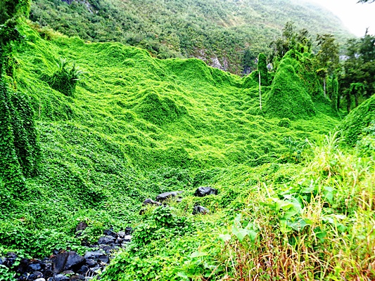
These vines covered entire hillsides and the trees on them. Made the scenery look smoothed over with green, rather than the sharp rocky surfaces that were really below it all.
We found that some of these vines were actually christophene/choko vines and the vegetable was growing under them along the roadside where we stopped, so we picked a few and at them for dinners and snacks.
A camera just doesn't capture the vista like the human eye, but these were pretty views.
Some interesting striped bamboo.
Another vista shot across a steep valley. Looks like they were growing things along the ridge part way up and when we looked through the binoculars, there were garden plots all up the slope! They used quad bikes, we guess to get the stuff up an down.
More waterfalls in the mist all along this road. The others got tired of stopping for photos as there were so many of them. Many countries would love to have one or more of these falls.
The Yellow River far below us. Huge boulders and the rocky banks created a different view.
Looking down the other side of the bridge, we could see a water chute that looked like it would be great fun to slide through. It was too cold for us to venture to do so, though.
Another vista of Cirque de Salazie

Here's Myra standing on a picnic area wall trying to see over the edge for a photo. The hillsides here were pretty steep.
This is looking down over the edge as far as we could.
We named the peak in the center the 'shark fin'. later in the day, we were on the other side of the valley looking back across to this spot.
Jason and Myra at the top of the ridge.
We watched the clouds make curlie Q's as they rose up over the edge of this peak.
Jason and Karen at another view point over Cirque du Salazie.
Another waterfall along the road.
And still more waterfalls along the drive. There are so many of them here!
Myra and Karen with waterfalls in the background.
Waterfall and the green humpy looking hillside covered in christophene vines.
This is a pretty high waterfall by anyone's standards. And we are in the dry season here.
A view from Cap Noir, looking back across Cirque du Mafate.
Looking back down at Le Port as we headed up for the final viewpoint of the cirque.
At the trailhead, we found this strawberry patch. They looked yummy, but we didn't want to steal their profits and hard work, so we left with just a taste.
Cirque du Mafate from the viewpoint at Cap Noir. We could see crossings along the river onthe right where the tour groups on quad bikes must cross. There is a walking tour that takes people from the north to the south of the island. It takes 13 days. You can see why if they have to hike up and down all these peaks and valleys.
The tip of the shark fin obscured in cloud from the other side, Cap Noir. Myra is watching the cloud roll on by.
Looking down at the river in the valley below. Looks like a thread that dropped from a breeze.
Looking further downriver from the viewpoint.


No comments:
Post a Comment