Unfortunately, we weren't observant enough all the time and had to turn back to the last verified spot of color and look for the right path several times. It seemed that when we took a wrong turn, it happened to be where a cow was in the path. Focusing on the cow and getting around it, we must've missed the spot of paint and headed off in the wrong direction. The views from the trails were great! This one is where we started a trail on our first walk.
A view of the reef on the SE side of the island from the bus window.
More bus shots as we headed to the town of Mourouk. The water on this side of the island is only accessible through a tiny pass and a winding river of deep water. The pass gets quite rough when the wind blows (and it almost always blows on this side of the island) and we could see the turbulent water from up here.
Looking the other way, you can certainly tell that this is a volcanic island. This looks like an old crater or caldera.
Some of the bus stops are painted in colorful oceanic scenes.
Jason as we started out on the trail. Looks like a road to begin with, but it quickly peters out and we were in the grassy/rocky hillsides.
A nice home with some eclectic architectural twists here.
The rock wall is nice around the pasture and the small dwelling.
As we set off for the walk from Mourouk to St. Pierre. Follow the yellow brick road......
Nice cliffside ocean views from our walk.
Rocky hillsides and casuarina trees along the way.
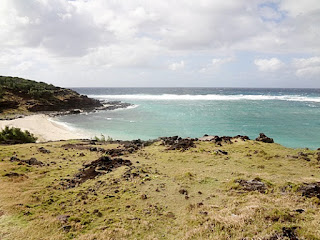
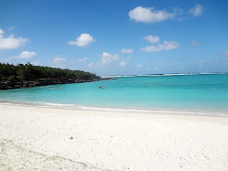
The colors of blue and green here were so much more stunning than photos can depict.
A kitesurfer's bungalow hotel on the SE coast of Rodrigues.
These little purple sea urchins washed up on one of the beaches where we walked past the river outlet.
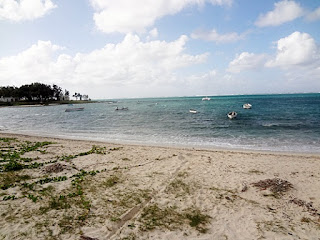
Local fishing boats tucked into the corner of a small bay along the shore.
A local boat on shore. They lay them high and dry and drag them out when they want to use them.
You can see the drag mark in the sand where someone has dragged a boat in or out.We stopped for a lemon juice and coffee here on our walk.
A parklike setting near the shore. The entire area we walked has no roads and is only accessible by hiking in or using a local boat.
Some cool rock formations. The limestone has fallen and eroded in weird ways. Lots of little caves here along the way, too.
looking down through a grove of casuarina trees to the ocean.
One of the river outlets we crossed on our walks. When the tide gets up, there may actually be water that flows in/out here.
Kerstin and Anne along the cliff as we climbed up from the riverbed.
Looking back at the beach and river outlet.
The grassy hillsides were strewn with limestone or volcanic rock so we had to watch our steps.
There were a series of bays that captured the sand and had beautiful beaches.
The turbulent waters of the pass into the southeast bay. You would only attempt to use this pass on a calm day and with the current. We did see it smooth on another day, but we all agreed we wouldn't want to try to take our yachts through this turbulence. We could see the eddies and standing waves caused by currents trying to go in different ways in the same space. There is only a tiny break in the reef here for all the water to pass through and it moves with incredible speed.
You can just see the tiny break in the surf line where the pass is.
Curling breakers rolling in over the reef.
One of the horseshoe-shaped bays along the coast. Small sandy beaches with steep cliffs to ensure privacy.
A closer view of the beach. There is a couple laying in the sand in the lower left corner. The previous day, there had been a dead goat washed ashore in that same exact spot! Some of us did this same walk several times as it is a very scenic walk that can start and end with a bus ride back to port.
A rocky hillside where the sheep and goats roamed.
A tunnel through the casuarina pine trees. They have long soft needles and tiny prickly pinecone seeds. They make a great windbreak.
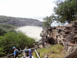
Another cave along the way.A bigger horseshoe bay with lots of sand We climbed down to it and back up the other side.
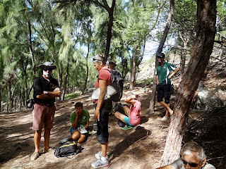
A rest along the way in a shady area. Chris on the left and his wife, Ann on the right are the couple off the dismasted yacht. That is Jason in the long white socks, and Kerstin off of Lop To in the middle.
More cool rock formations.
Karen at the top of a cliff. It was so windy I had to change my hat from a baseball cap to this bandana.
You can see the effect of the sweep of the wind on these trees below us.Another sandy beach in a tiny bay. Developers would love to have land like this but Rodrigues has kept this a national park and refused to allow roads in to access these areas. Almost 90% of this island is government land they are trying to keep in its natural state. Only 10% is privately owned and those folks are usually wealthy and have been here a while.
A look back at a beach from up on high.
Near the end of the trail, there were actually stairs and a hand rail. Must be some resorts nearby.
The multilayered cliffside we climbed down next to.
You can see the layers of rock and their tilt from eons of seismic and volcanic movements.
What a beach, eh? This is at the base of those layered rocks.
A bit further along, we ran into a different type of growth--a huge prickly pear cactus.
At the end of the trail, we stopped for lunch at this little restaurant and our friends from Crystal Blues rode up on their rented motorscooter. This is literally the end of the road for vehicles so they knew where to find us.
The view from the restaurant site.
Looking back at the little restaurant as we headed down the hill and across the beach below.
Jason on the bus on the ride back to port. School kids piled on at one stop and the noise level jumped a lot of decibels as they all shouted to each other.
Jason put his hat on one of the kids and he wore it for a while but insisted he didn't want it and gave it back to him.
Another day, another walk. This one was further inland and we could see the same horseshoe bays we'd walked along previously.
Sean and his homemade umbrella.A nice beach at the bottom of a tough descent of a rocky, cactus- and acacia-thorn ridden hill with lots of loose rocks. Our 'guides' had never been this way before and it showed. I ended up with bloody hands and arms from the many sticks and stickers that grabbed my arms and hands as I tried to step gingerly down the hill.
The beach was quite pretty and the water looked very inviting at this stage.
We climbed down this hill and walked all the way out to that headland, as well as up and over it and far beyond. This was the 'walk from hell' that took over eight hours. It would have been ok, but the port captain who arranged it said it was only three hours and we ran out of water with no stores around. Endurance prevailed and we got back safely, but we decided we wouldn't go on any more walks with the port captain and his friends.
There are goats in the middle of this picture and we felt like goats as we had to climb and scramble over rocks to get back to civilization.
Nice views though. There were several people who felt like channeling Julie Andrews, with outstretched arms and singing "The hills are alive with the sound of music". Truly! And this happened on more than one walk here!
A goat striking a pose for us on a rocky cliffside.
A break along the way. Break out the baguettes.
Sean putting his umbrella together to keep the sun off of him. Notice he is barefoot so he "can feel the earth" as he walks. Sharp plants and stones assailed his feet but he persisted.
We stopped again at the same restaurant at the beach at the trail's end, This time it was for lunch and we continued on for several more hours trekking.
The beach below the restaurant.
A few resorts along the way for those who want to get away from it all in style. These are the beach lounge chairs. A cool design I thought.
One of the bigger beaches along the eastern side of the island.
Plumber's crack is universal. This was one of our 'guides' when we stopped for another food break at the far end of the beach area.
Another Julie Andrews scene as we climbed over another hill.
The little white specks you can see are more of our group climbing down this hillside to reach the beach where I am. This was uncharted territory for the guides and they were just making it up as they went along here. Those trees are covered with long sharp spikes on the branches and we had to climb through a grove of them. The thorny acacia trees are an invasive pest species that they are now trying to get rid of. But they have a firm stonghold here and they are tough to kill.
Looking up a gully from the beach.
We had to rock hop all the way along this beach to that notch in the next headland. We were lucky the tide was out and we could find footing on the rocks. Still, it was tough on the feet as we'd been hiking for over five hours already.
We're still rock hopping at the far end of the beach, but we had to climb now to get to the other side.
A fairly newborn sheep along the way. They are so cute when they are so tiny.
More rest stop shots from earlier in the day.
A flock of goats that arrived at the restaurant just as we were leaving.
Ann and Karen decided to test out the lounging beds on the beach of the hotel with those funky wicker lounge chairs.
Local boats tucked into the calm corner of the beach below the restaurant.
A line of us hikers along the trail of rocks, thorns and cactus.
Walking along the beach for a stint. Our shoes are on their last legs and let the sand into them. Jason's soles have peeled off and he is walking on the inner sole with just a few dangling flaps of rubber left on the bottom. Can't say he didn't get his money's worth out of his shoes.
Occasionally we had to stop to wait for any stragglers. This is not a country where you want to get lost or hurt out on one of these walks. There were areas where there was no cell phone coverage so rescue would be a long wait.
Another view of one of the pretty bays we'd walked past on a previous day. We're much higher up and farther inland this time.
A cold Phoenix beer was welcome at the restaurant. Our group drank them out of the normal sized bottles and only had the big bottles left. Somehow, we made do with more beer.
The waters of the pass into the SE bay from the cliff top.
Pretty cove in the corner of a bay.
Signs of civilization with a cell tower in the distance. We walked all the way to it and beyond.
A rocky gully we didn't have to go into. We had to climb the cliff beside it to get over to the other side.
The climb up from the beach.
And the climb back down. It was pretty steep and had some slippery rock faces to negotiate, but we all made it pretty much unscathed.The view from the gap as we climbed through. We had to walk all the way along that beach and past that headland to get back. It was a loonnnnnnggggg hike.
A stop along the way to rest. We finally found a shop that would open and sell us a bottle of pop/Fanta and a couple of bottles of water. That saved our bacon that day.
A cave along the way in the rocks.
The pass actually looked doable this time. No breaking surf, and the water looked calm enough to negotiate the pass in a boat. But we still weren't going to try it. One could get caught in there until the next calm day before you could get out. That could be weeks at this time of year!
Hiking in Rodrigues has been fun and good exercise. It gives us a good reason to get off the boat and stretch our muscles.












No comments:
Post a Comment